



Sheffield is the largest English city without a motorway running into its heart, and it manages perfectly well without one. Instead, the Parkway carries almost everything in from the M1, climbing gently from the Don valley into the centre. The city rises steeply on every side, which is why the tram network was built the way it was and why so many residential streets are simply not places you take a large car in winter.
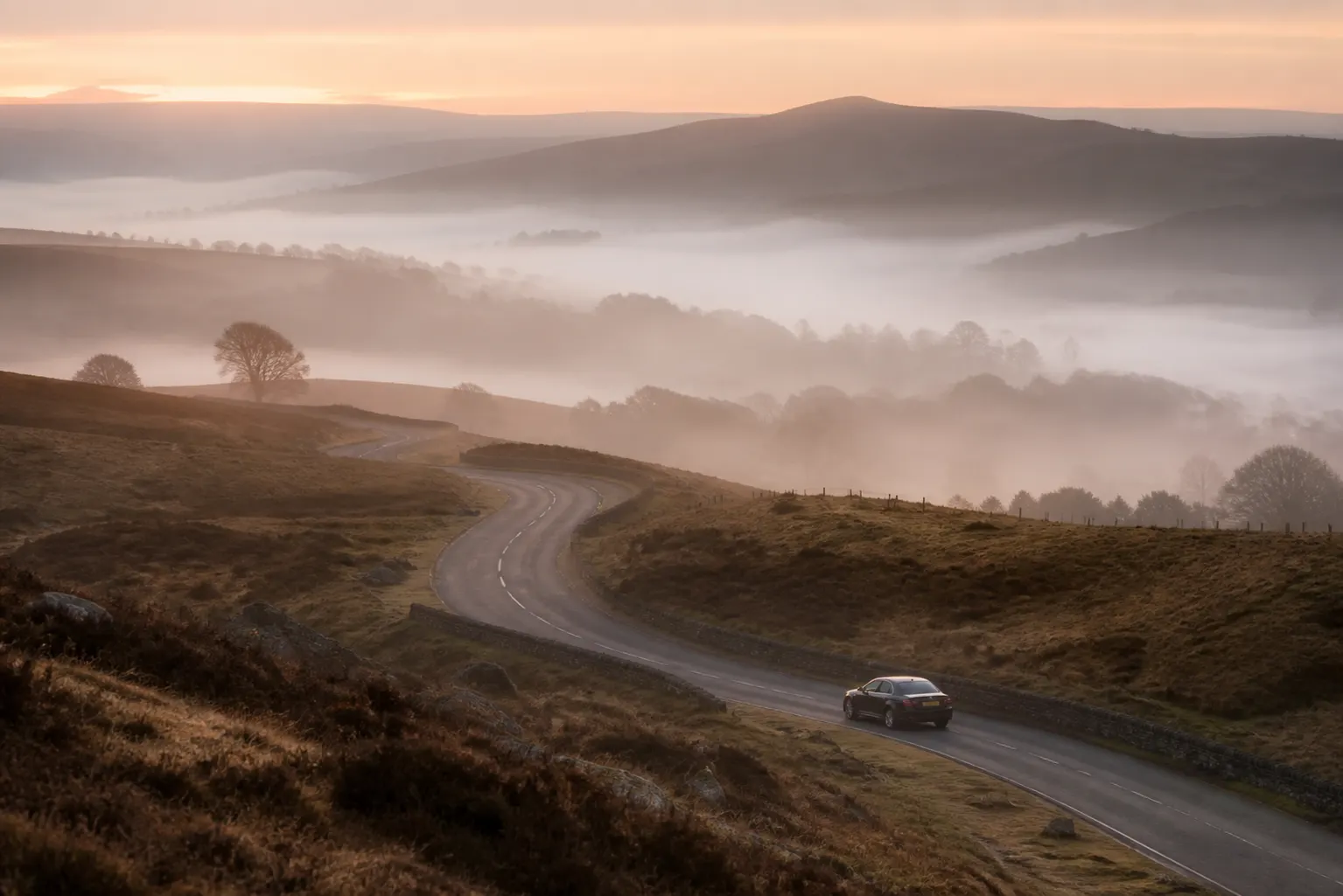
The other defining feature is proximity. The Peak District begins at the western edge of the city, close enough that a client can finish a meeting in the centre and be walking on moorland within half an hour. That is a genuine luxury, and it comes with the practical consequence that some of the finest roads out of Sheffield are also the first to close when the weather turns.
The Parkway and the junctions that matter
The Sheffield Parkway leaves the M1 at junction 33 and runs west into the city as a dual carriageway, which makes it the default arrival route from London, Leeds and the Midlands. It is efficient and it is busy, and its lower end feeds directly into the inner ring road where the traffic slows abruptly.
Junction 34 serves Meadowhall and the arena to the north east, and it is worth knowing that this junction behaves quite differently on a Saturday in December than on a Tuesday in February. Junction 36 to the north is the route to Chapeltown and the Barnsley side, and junction 31 to the south serves the airportless southern approach towards Chesterfield.
Inside the city, the inner ring road runs around the centre and works reasonably well provided you commit to it. The alternative, cutting through, involves the tram, the hills and a great many bus lanes, and it is rarely faster. As with several northern cities, the counter-intuitive route is usually the right one.
Trams, gradients and the central core
The Supertram runs on street through the middle of Sheffield, sharing road space in some places and taking it entirely in others. Around the High Street and Church Street the arrangement gives trams priority and restricts general traffic, and the sequence of permitted movements is not obvious to anyone driving here for the first time.
Fargate and The Moor are pedestrianised, forming the retail spine, so vehicle access is confined to the surrounding streets. The Devonshire Quarter and Kelham Island, both busy in the evenings, sit in older street patterns with narrow carriageways and very little legal waiting. We agree collection corners in advance for those areas rather than hoping something appears.
Gradient matters more here than most people expect. A set-down two hundred metres away can involve a serious climb, which is worth mentioning at the point of booking if anyone in the party would rather avoid it. We would rather drive an extra few minutes to arrive at the right level.
- Supertram shares and restricts road space through the central streets
- Fargate and The Moor: pedestrian, access from surrounding roads only
- Kelham Island and Devonshire Quarter: narrow streets, limited waiting
- Inner ring road is usually faster than cutting across the centre
- Gradients mean the nearest set-down is not always the easiest
- Clean air requirements for your vehicle confirmed at the time of booking

The station, the arena and Meadowhall
Sheffield station sits on the eastern edge of the centre with a forecourt at Sheaf Square. The area handles taxis and buses, and private car access is limited, so collections work from the permitted points nearby. Beyond the square the ground rises sharply towards the centre, which is another reason to confirm the meeting point in advance rather than agreeing to meet at the front.
The arena and the retail centre share the same corridor out at junction 34. On a concert night or a Christmas Saturday that corridor carries far more than it comfortably can, and the exit afterwards is slow in every direction. We plan collections there on the basis of where the car can get out rather than where it can get in.
The city also operates a clean air scheme in the central area. Standards and arrangements are set by the council and subject to revision, so we confirm the position for your vehicle on your travel date. Where a charge applies it forms part of the written quotation agreed before booking.
Bramall Lane, Hillsborough and the sporting calendar
Two football grounds sit at opposite ends of the city, and both bring local closures on the day. Bramall Lane is close to the centre south of the ring road, which means matchday traffic interacts with ordinary city traffic. Hillsborough sits north west in a dense residential area along the Loxley valley, where the approach roads are limited and the parking is heavily restricted.
The snooker world championship at the Crucible fills the centre for a fortnight each spring, though its effect is on hotels and restaurants rather than road closures. Big events at the arena have more impact on the roads, and the annual half marathon closes central and southern routes for a morning.
For all of these the same discipline applies. Agree the collection point in writing, choose it for its exit rather than its proximity, and accept a short walk. It is a considerably better experience than sitting in a car that cannot move, and it keeps the chauffeur out of the queue as well, which matters when the next appointment is on the other side of the city.
The Peak District on the doorstep
Few cities have this. The moors begin within the city boundary to the west, and Hathersage, Bakewell and Chatsworth are all comfortably inside an hour. The A57 Snake Pass and the A625 through Hope Valley are among the most enjoyable roads in England, and Chatsworth in particular makes an easy half day from the centre.
The caveat is winter. The Snake Pass and the Woodhead route across to Manchester both close in snow, sometimes for days, and they close before almost anything else in the region. When they do, the alternative is a long detour via the M1 and M62 or the lower A628 corridor, and a journey that would normally take an hour can take two and a half.
For airports, Manchester is the usual choice, commonly around an hour to an hour and twenty minutes depending on which trans-Pennine route is running well. East Midlands and Leeds Bradford are both realistic alternatives, and we will say honestly which suits your particular flight rather than defaulting to one.
- Centre to Chatsworth House: commonly around forty five minutes
- Centre to Bakewell: usually forty five minutes to an hour
- Centre to Manchester Airport: generally an hour to an hour and twenty minutes
- Centre to East Midlands Airport: usually around an hour
- Centre to Leeds: commonly around fifty minutes to an hour on the M1